authoriti.ai

THE PLATFORM

Planning decision support for local authorities.

The production system, not coming-soon screenshots.

AVAILABLE NOW

Statutory consultation synthesis

Every public and statutory representation is filtered, tagged and aggregated automatically: stance, topic and the concerns that actually drive objections. Hours of reading synthesised to a live page.

Sentiment counts, concern themes and predicted outcome sit above the underlying evidence. Every figure traces back to the representations behind it.
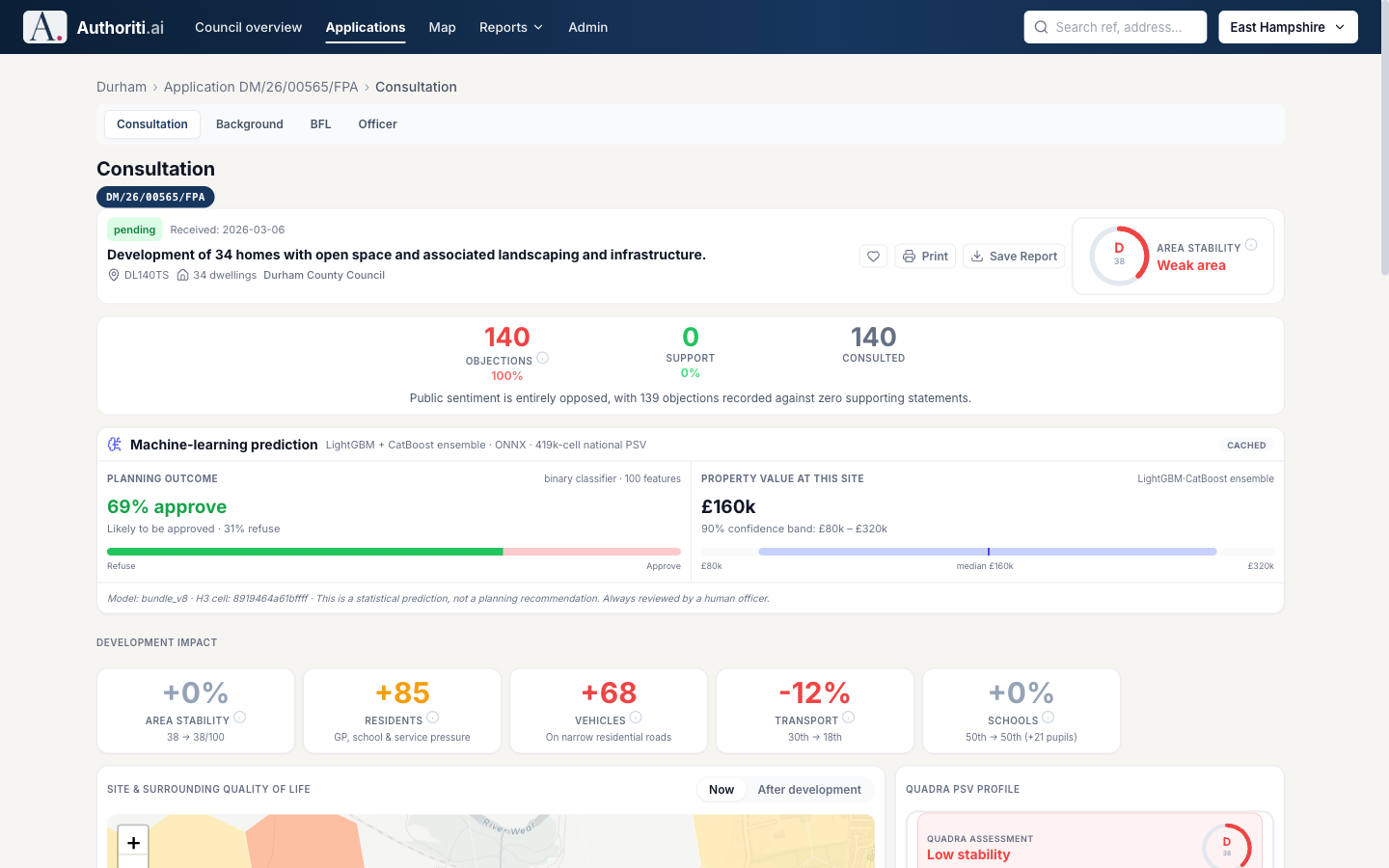
Consultation analysis for a live application: objection, support and consultation counts with a machine-learning outcome prediction
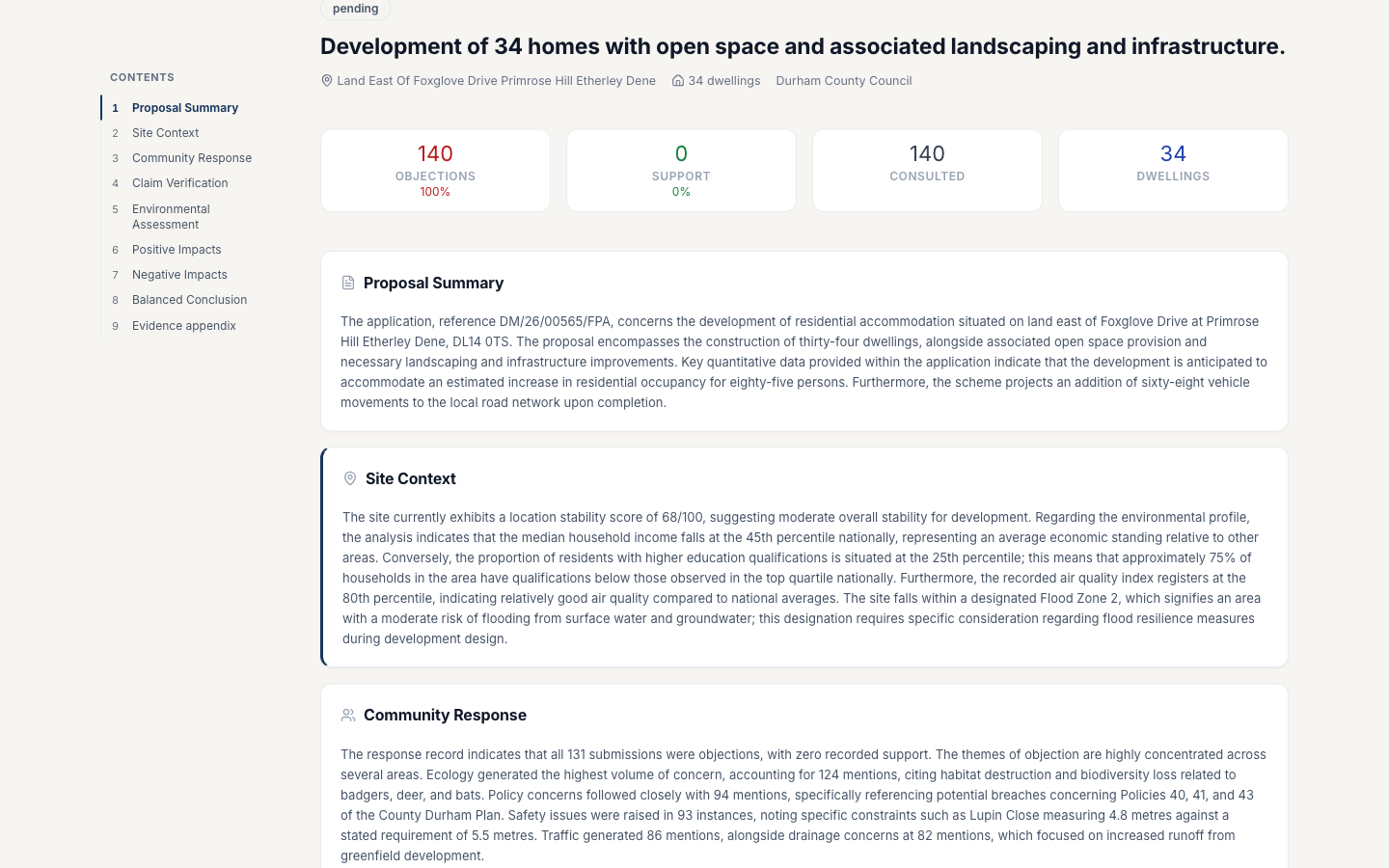
A generated background report with proposal summary, site context and community response sections

AVAILABLE NOW

Legally traceable planning reports

Structured report drafts, proposal summary, site context, community response, policy considerations, generated from the evidence base and ready for an officer to review, edit and own.

Every claim links to its source. Officer edits are preserved as overrides, so regeneration never silently rewrites professional judgement.

AVAILABLE NOW

Building for Life 12 design review

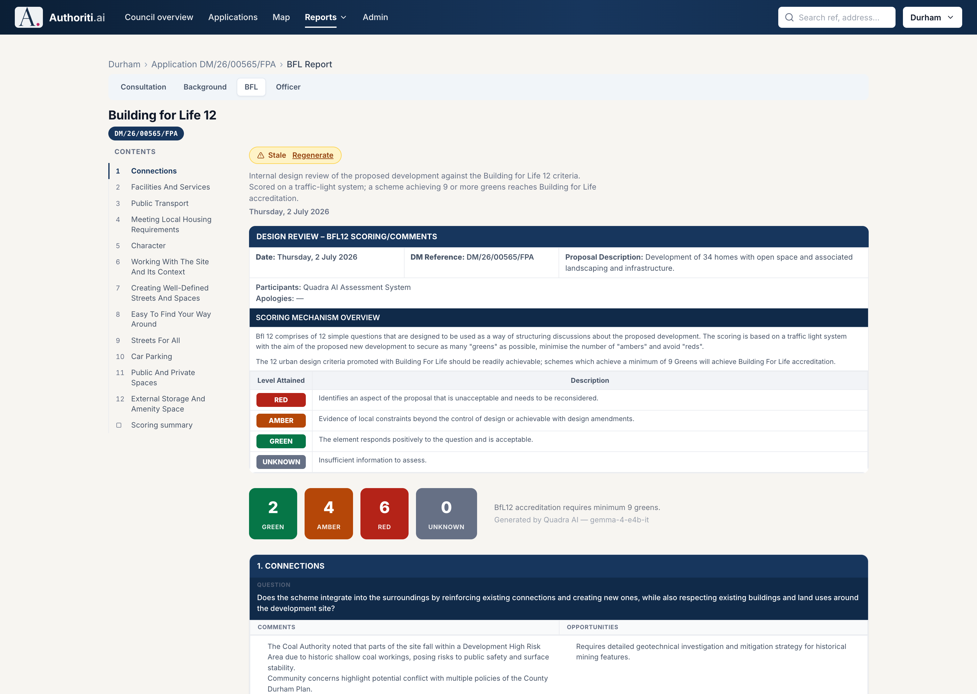
Every residential scheme can carry a structured design review against the 12 Building for Life criteria, the national design-quality standard: connections, facilities, public transport, character, streets and parking, traffic-light scored with the reasoning clearly explained.

Reds and ambers arrive with commentary and identified opportunities, giving officers a structured, evidenced basis for negotiating design amendments, while also giving members a clear picture of scheme quality before committee.

A Building for Life 12 design review: traffic-light scoring across the twelve criteria with green, amber and red counts and per-criterion commentary

AVAILABLE NOW

20-minute neighbourhoods, measured along the routes people actually use.

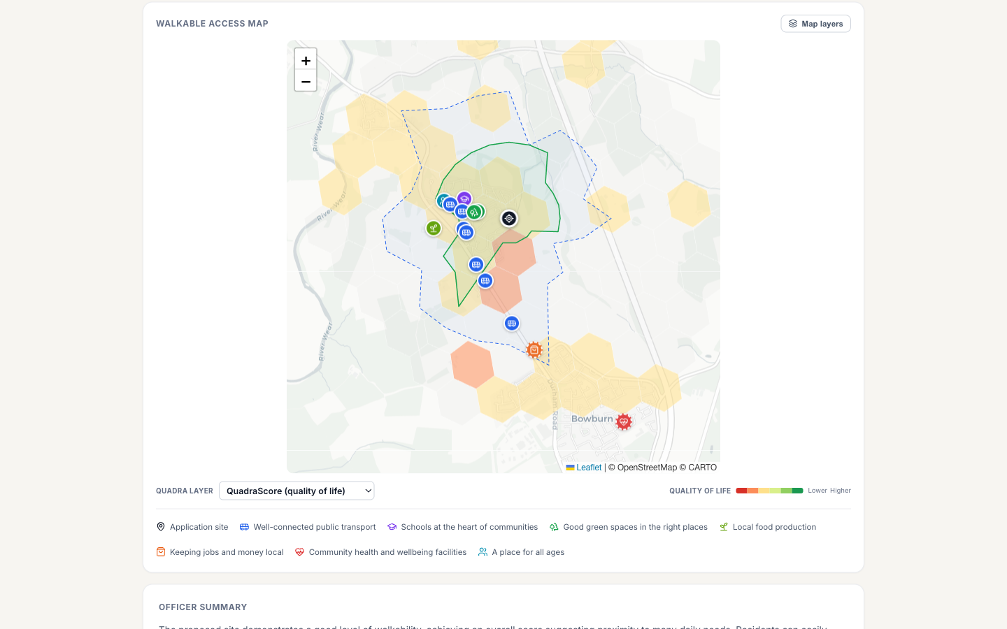
Most walkability tools plot a simple radius on a map and call it a catchment. But a river, a railway line or a missing footbridge along the way turns that radius into a fiction. Our analysis routes every journey along the real street and path network, so a shop 300 metres away across an unbridged river is shown correctly a 25-minute walk, not a 4-minute one.

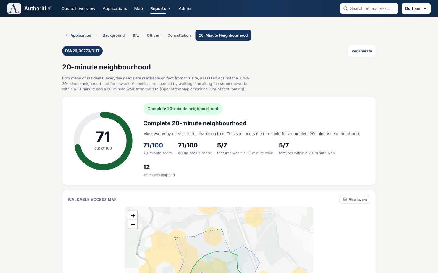
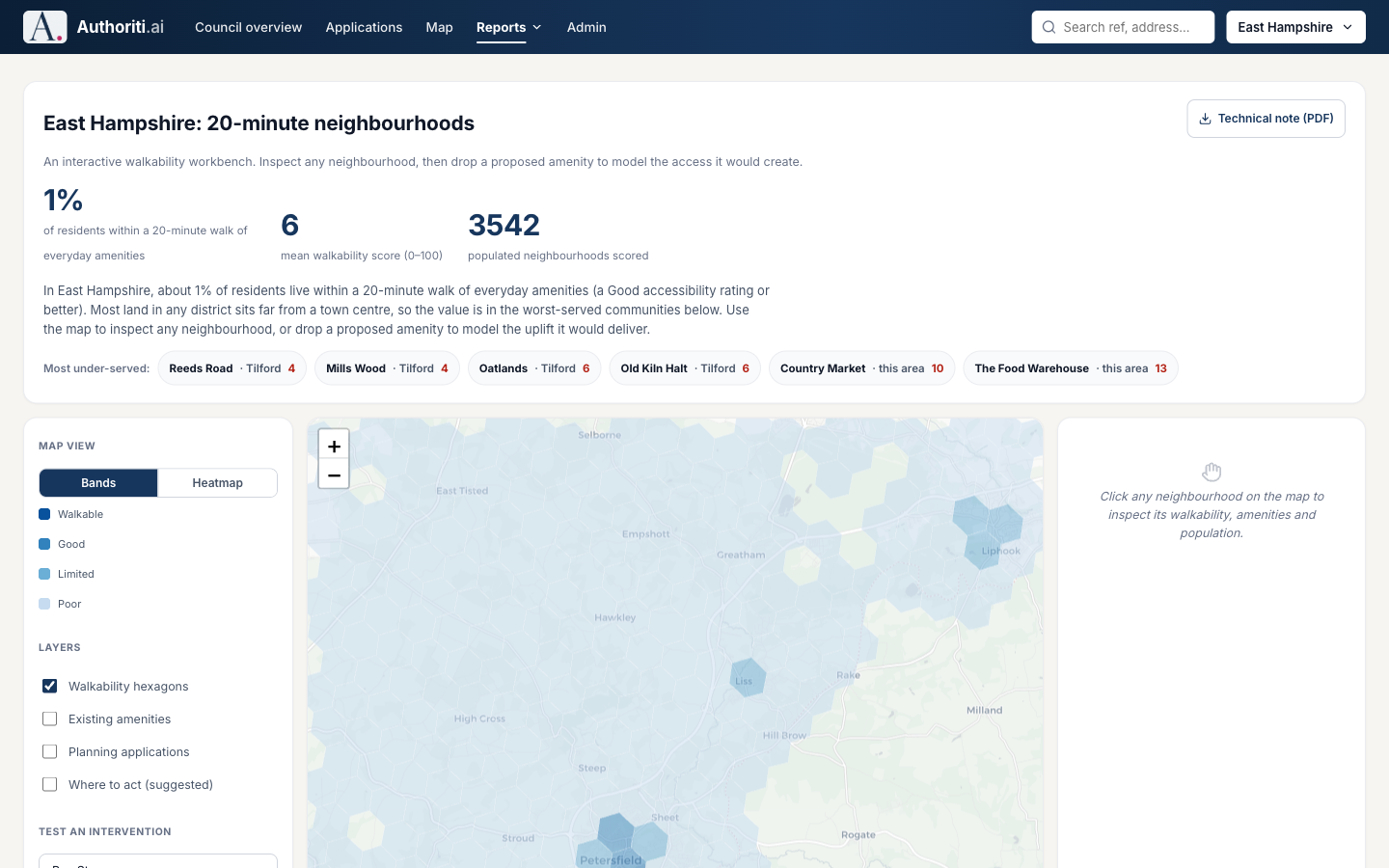
Every application can carry a 20-minute neighbourhood report scored against the TCPA framework, and the same engine assesses every populated neighbourhood across the whole district.

A walkable access map showing organic 10 and 20 minute isochrones that follow the actual street network around an application site, with amenity markers
A 20-minute neighbourhood report scoring an application site 71 out of 100 against the TCPA framework, with walking-time feature counts
The district-wide 20-minute neighbourhood studio: thousands of populated neighbourhood cells scored for walkable access across the whole council area
The council-wide view: 3,542 populated neighbourhood cells assessed for walkable access to everyday amenities, both interactively and in a technical PDF.

AVAILABLE NOW

Open space assessments with evidence-base quality

A full district open space assessment, quantity, quality and accessibility, on a par with reports councils commission externally for tens of thousands of pounds but at a fraction of the cost. With standardised methodology and calculations, these reports are reproducible year on year: change in the next edition is real change, not a new consultant’s method.

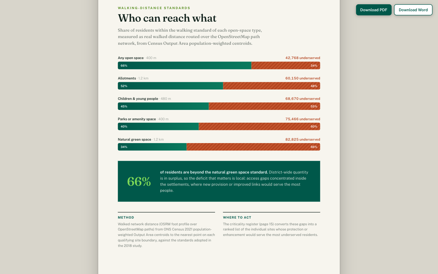
Accessibility is measured the same way: real walked distance routed over the path network from population-weighted census centroids, ranked against adopted local standards. Beneath it, our Quadra probability engine models access, amenity and quality-of-life signals for every neighbourhood cell. The output is a designed document with a criticality register your policy team can act on, delivered as a PDF or Word document.

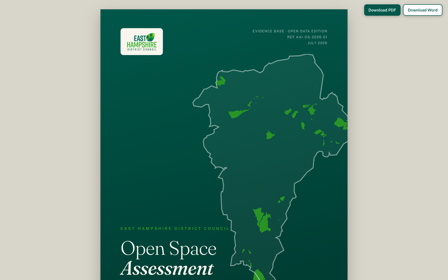
The cover of a generated district open space assessment: an evidence-base quality document with the district boundary and open spaces mapped
An accessibility analysis page showing the share of residents within the walking standard of each open space type, with underserved population counts

The platform roadmap

The next evolution of the Authoriti.ai platform builds on the core methodology that powers its planning tools.

Building control analytics

Adapting the document-parsing and regulatory text analysis engine to automate compliance checks for building control inspectorates.

UNDER EVALUATION

Local land charges search

Applying the regional spatial index to rapid, automated property history lookups and local boundary constraint queries.

UNDER EVALUATION

Answers to your IT team's questions.

The Trust Centre contains the architecture, security, isolation and responsible AI detail your governance review needs.